
If you have followed Flow Lane, all of the way to where it terminates at the Teign Estuary, you may have noticed a triangular plot of land on the left as you pass underneath the railway bridge, between the railway line and the estuary, signposted as a private nature reserve. This is Flow Point County Wildlife Site (CWS). Ordnance Survey mapping from 1889 name this area as ‘Floor Point’ and the area was depicted a ‘saltings’, which means an area of coastal land that is regularly covered by the tide, which comprises saltmarsh.
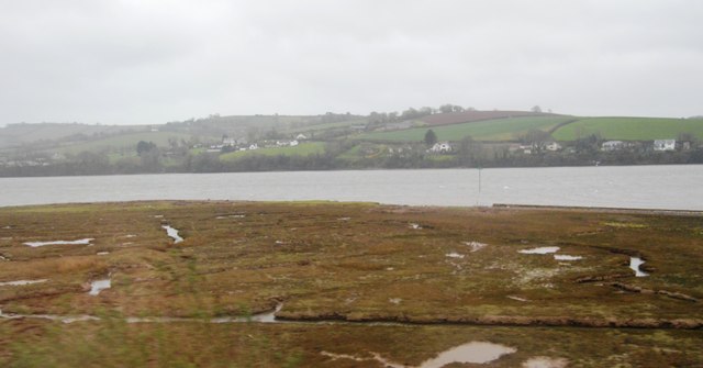
Flow Point saltmarsh
photo © N Chadwick
Flow Point is designated as a CWS primarily for the presence of the saltmarsh. It is a sensitive habitat and contains an array of flowering plants that are visible in the spring and summer. Saltmarshes comprise the upper, vegetated portions of intertidal mudflats, lying between mean high water neap tides and mean high water spring tides. Saltmarsh vegetation comprises salt tolerant species adapted to regular immersion by the tides.
Saltmarshes are an important resource for wildlife by acting as high tide refuges for birds feeding on adjacent mudflats, as breeding sites for waders, gulls and terns and as a source of food for passerine birds particularly in autumn and winter. They also act as a valuable natural flood-defence, dissipating wave energy and reducing scour. Since medieval times, many saltmarshes have been reduced in extent by land claim and conversion to agricultural use. As a consequence saltmarshes have become a scarce habitat in England.